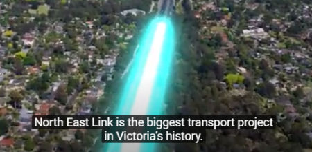
 The draft Yarra Strategic Plan claims to deliver the first Victorian integrated river corridor strategy and to identify immediate actions for the river corridor, enabling long-term collaborative management between agencies and Traditional Owners. It is intended to guide local planning. We publish here a critical submission to this draft plan. Summary of submission by candobetter editor: Climate Change and human failure to interact safely with the natural world. Plan fails to adequately factor in transport interaction with Yarra. Lack of proper transport interconnectivity. Higher density depends on high quality public transport. Private car still dominates. Forecast population growth and new constructions will inevitably cause major environmental damage. North-East Link Freeway will comport massive land-fill problems, hardly referred to in Draft Plan. Likely potential for destabilisation of groundwater in the Yarra Valley in the Bulleen and Rosanna area as a consequence of the North-East Link Freeway project. Substantial areas of public open space is threatened by the project, together with about 25,000 mature canopy trees. Adverse human health effects of the project would include increased air pollution and heightened road noise. Lack of cycling provision on roads in cities of Boroondara, Banyule, Manningham and Maroondah and the Shires of Nillumbik and Yarra Ranges. Proposal in Plan to increase lanes capacity on the Eastern Freeway to cater for the North East Link project by over 40%, from 802,000 square metres to 1,127,000 square metres. Adverse environmental effects would include increased run-off of polluted stormwater into the Yarra River and elevated ambient temperatures as a consequence of the large increase in concrete and asphalt surfaces. Report of the Commissioner of Sustainability, State of the Yarra and its Parklands (2018), concluded that the status of the Yarra river was poor for 18 of its 25 environmental indicators. This can only deteriorate if planned stressors go ahead.
Submission on the Draft Yarra Strategic Plan


Introduction
The draft Yarra Strategic Plan rightly identifies climate change as a threat to the Yarra River. In this regard, climate change is neither more or less than a register of the failure of the human species to interact properly with the natural world. COVID - 19 also falls into that category.
Transport and the Yarra
The draft Plan gives too little attention to the relationship between transport and the health of the Yarra. This is a major flaw. The functionality of large cities is decided more than anything else by the dominant modes of mobility deployed in them.
The draft Plan declares (p. 16) that the Department of Transport "plans, builds and operates an integrated, sustainable and safe transport system across Victoria. It does not, actually, as little effort is made to integrate the various modes. Within the public transport sphere in particular, insufficient effort is made to ensure the connectivity of the network.
Even more importantly, the concept of integrated transport and land use planning has pretty much been abandoned by the Victorian government, and has done so since Melbourne 2030, with the concept of the poly-centric city at its core, was all but forgotten.
The idea (p. 12) that higher density residential development should be the sole province of inner areas is flawed. There is significant demand for higher density residential development in locations well removed from inner Melbourne. The central problem is that the government has abandoned the key enabler of this, which is high quality public transport across the whole of Melbourne.
The reality is that the modal mix for personal travel in the City of Melbourne is little different from what it was 50 years ago. The private motor car dominates. And it is very space-inefficient.
The draft Plan anticipates that Melbourne's population will grow to nearly 8 million by the year 2051, and with an extra 140,000 dwellings to be built in the Yarra River corridor by 2041.
There are no grounds, within current policy settings, that these "milestones" would be reached without damaging the environment very seriously. The central issue is that the Victorian government does not have a transport plan for Melbourne.
North East Link
The Victorian government's North East Link freeway project is hardly referred to in the draft Plan. It should be. It was developed in the absence of any consideration by the government of other forms of transport, and especially public transport, which would have a relatively benign effect on the Yarra River corridor.
It is understood that the extensive tunnelling proposed for the project would require the excavation of about 1.5 cubic metres of rock and soil, which would go to landfill (see Timna Jacks and Benjamin Preiss, "Warning over toxic soil from 'big dig,'" Sunday Age, December 1, 2019). It is not known whether any of the material is toxic and there appears to be insufficient landfill capacity to take it.
There appears to be potential for destabilisation of groundwater in the Yarra Valley in the Bulleen and Rosanna area as a consequence of the project.
Substantial areas of public open space is threatened by the project, together with about 25,000 mature canopy trees.
Adverse human health effects of the project would include increased air pollution and heightened road noise.
Paved surface area
One of the dysfunctional elements of the dominance of the motor car is the increase in paved road surface that is required to cater for ever-growing motor vehicle numbers. For instance, it is proposed to increase lanes capacity on the Eastern Freeway to cater for the North East Link project by over 40%, from 802,000 square metres to 1,127,000 square metres. The adverse environmental effects would include increased run-off of polluted stormwater into the Yarra River and elevated ambient temperatures as a consequence of the large increase in concrete and asphalt surfaces.
Local government and transport
It is not only at state government level that we have major policy failure in transport. For instance, if one is to consider the land area of the City of Boroondara, it is comprised of about 6,022 hectares, of which 1279 hectares, over 20%, is comprised of road reservations. About 80% of the land devoted to road reservations is controlled by the City of Boroondara, with the balance controlled by VicRoads. The reservations controlled by Boroondara contain about 560 kilometres of local roads.
Significantly, very few of these roads have been developed to provide for safe cycling traffic. They are designed, with few exceptions, exclusively for motor car traffic. Apart from the City of Yarra, the other councils with a direct interest in this project (the cities of Banyule, Manningham and Maroondah and the Shires of Nillumbik and Yarra Ranges), also appear relatively uninterested in increasing the mode share of space-efficient, and therefore environmentally friendly forms of transport.
Conclusions
The Status Assessment contained in the report of the Commissioner of Sustainability, State of the Yarra and its Parklands (2018), concluded that the status of the river was poor for 18 of its 25 environmental indicators.
These measures will continue to deteriorate unless substantial reforms are made to transport capacity in Melbourne, and especially in the Yarra River corridor, to preference space-efficient and less carbon polluting transport modes.
Ian Hundley
29 March 2020
Topic:
- groundwater
- Boroondara
- Banyule
- cycling
- stormwater
- runoff
- Manningham
- Maroondah
- Nillumbik Shire
- Yarra Ranges Shire
- hard surfaces
- heat islands
- North East Link
- Melbourne's overpopulation problem
- Melbourne's overdevelopment problem
- public transport
- draft Yarra strategic plan 2020
- high density
- climate change
- environment
- planning
- Melbourne
- Australia

Add comment