 Western Sydney residents are up in arms about having an urban rail line, a freight rail line and a mega motorway through their communities and bushland. Hundreds will be protesting 6.30 pm Thursday 7 August, 2014, at the St Marys Community Centre, St Marys, NSW, Cnr Mamre Rd & Great Western Hwy., where Transport for NSW and Tanya Davies the local Liberal MP have reluctantly agreed to hold an extraordinary community consultation drop in session. They want to know what we think of their plan so we intend to let them know loud and clear: 'We don't like it'.
"Its not just a South West Rail Corridor its also the Outer Sydney Orbital which consists of the M9 motorway and an attached freight train rail line. 24/7 through our communities and bushland. The majority of protesters will be disgruntled Liberal voters"
"STORC therefore is very concerned that all these projects, in combination, becomes an infrastructure bomb that people, communities and the environment will never recover from. All these projects are being assessed and approved individually, in isolation to one another. Where’s the assessment of the cumulative impacts?"
"Of great concern is that the NSW Government can reserve the South West Rail and the Outer Sydney Orbital corridors and lock in the route through critically endangered bushland and people’s homes without the need to do an EIS. So once the land is acquired and community is out of the way and worn out the government then does its EIS and only has to exhibit it for 30 days. What a joke."
"So STORC wants the clock stopped on the SWRC and OSO process. We want to know the impacts of these projects before the corridor is reserved. The NSW Government and Local Government should therefore carry out a thorough environmental and social assessment/study (separate to an EIS process) to determine the cumulative impacts of these projects. The NSW Government and Local Government should also call that the EIS for a Badgerys Creek Airport come first and that it include the impacts of the infrastructure projects STORC has mentioned as they are all part of a Badgerys Ck Airport package."
"The residents of outer Western Sydney deserve to know from the NSW Government what the cumulative impacts will be on them and the environment."
PUBLIC PROTEST
WHEN: 6.30 pm Thursday, 7 August 2014
WHERE: St Marys Community Centre, Mamre Rd
WHAT: Meeting with Tanya Davies & NSW Transport Dept.
Flyer
Do you live in Orchard Hills, Claremont Meadows, Werrington, Llandilo, Windsor Downs?
Are you aware of what has been planned for your suburb?
1. MEGA M9 OUTER SYDNEY ORBITAL CORRIDOR
2. INDUSTRIAL FREIGHT TRAIN RAIL LINE CORRIDOR
3. DOMESTIC TRAIN RAIL LINE CORRIDOR
4. 24/7 AIRPORT, FLIGHT PATHS – WITHOUT CURFEW!
NO CONSIDERATION OF CUMULATIVE IMPACTS THESE FOUR MAJOR
PROJECTS WILL HAVE ON RESIDENTS & OUR LOCAL ENVIRONMENT
- WHOLE COMMUNITIES IMPACTED
- 24/7 IMPACT NOISE (TRUCKS, TRAINS & PLANES)
- POLLUTION
- OUR WAY OF LIFE LOST
- OXYGEN-GENERATING GREENSPACE DESTROYED – REPLACED WITH UGLY HEAT-TRAPPING CONCRETE & TARMAC
- OUR REMAINING GREENSPACE LOST TO DEVELOPERS & MORE URBANISATION
- LAND TAKEN
- RESUMPTION OF HOMES
- PROPERTY VALUES TRASHED
- CONSERVATION LAND DESTROYED
NO IMPACT STUDIES UNTIL AFTER APPROVAL!
10,000 ha OF FARMLAND CLEARED FOR FACTORIES & WAREHOUSES. MEGA INTERMODAL
BUILT SOUTH OF ORCHARD HILLS TO FILL THE M9 MOTORWAY WITH TRUCKS!
BRING YOUR PROTEST SIGNS, YOUR QUESTIONS, FAMILY & FRIENDS
SEE YOU THERE!
STORC Action Group – Stop The Orbital & Rail Corridor
www.facebook.com/STORCActionGroup www.wsca.org.au [email protected]
SUPPORT US BSB: 814-282 Acc: 50444587
Backgrounder
Stop the Orbital and Rail Corridor Action Group (STORC)
Is anybody assessing the cumulative impacts of multiple government infrastructure proposals on western Sydney’s people and environment? NSW Government must stop the clock.
The April 15, 2014 announcement by the Federal Government that it will construct Sydney’s second International Airport at Badgerys Creek was followed days later by a NSW Government announcement that it would reserve a corridor to extend the South West Rail line. The proposal is for the South West Rail Corridor Extension (SWRC) to go north from Narellan to the western line near St Marys. A station is proposed to be built at Badgerys Ck.
This line would also connect to Leppington and the southern line.
The NSW Government has commenced community consultation about a preferred route and during this process community concern has risen and a community group Stop the Orbital and Rail Corridor Action Group (STORC) has formed to oppose a likely route that puts economic growth ahead of protecting the public interest.
STORC’s concerns stemmed from a Penrith Council submission to Transport for NSW (TfNSW) that urges they approve a route that connects new stations at a proposed Sydney Science Park to the UWS Werrington Campus. The Council map was overlayed on Google Earth and was shown to go through critically endangered bushland at the Defence Establishment Orchard Hills and also homes and properties in Orchard Hills. Orchard Hills residents were blindsided by Councils submission as they were not even aware TfNSW first 6 weeks of community consultation had been and gone.
Penrith Councils submission was written after meetings with TfNSW, UWS and other Councils. So it has provided the community with a lot of information of likely impacts.
From Councils submissions STORC learnt that the proposed Outer Sydney Orbital (OSO) was also imminent and that it would consist of an M9 motorway and an adjoined freight rail line.
A Penrith Council report of June 23 states TfNSW wants the SWRC and the OSO reserved as separate corridors. Council maps also showed the OSO and when overlayed on Google Earth going through the Defence Establishment Orchard Hills and homes. The impact of the OSO however is greater as it is proposed to run from South of Camden to the Central Coast. The Google Earth overlay in the Penrith Region shows it also runs through million dollar homes in The Vines Estate, through urban Claremont Meadows and Werrington, through the critically endangered bushland at the ADI Site (Wianamatta Regional Park that the community fought for over a decade to protect), through rural Llandilo and Berkshire Park and through million dollars homes at the Windsor Downs Estate.
So residents are up in arms about having an urban rail line, a freight rail line and a mega motorway through their communities and bushland.
Then when you drill down into the Penrith Council report you see these infrastructure items are to serve a proposed 24/7 Airport at Badgerys Creek and also the proposed Broader Western Sydney Employment Area (BWSEA). The BWSEA is a proposal to rezone 10,000 hectares of rural land to industrial. So 10,000 ha of green space are to be covered by factories and warehouses. Productive farmland gives way to a sea of cement and tarmac.
The BWSEA zone includes the Badgerys Ck Airport land in the south and runs all the way north to border onto the Orchard Hills Defence Establishment.
You drill down further into Penrith Councils report and you see advanced discussions have been had about the building of an intermodal facility west of the BWSEA. Council urges TfNSW when reserving the OSO corridor to reserve sufficient land for the new intermodal.
Add in Tony Abbott’s funding to widen Bringelly Rd, Elizabeth Dr and large parts of the Northern Rd to facilitate more car and truck use.
STORC therefore is very concerned that all these projects, in combination, becomes an infrastructure bomb that people, communities and the environment will never recover from. All these projects are being assessed and approved individually, in isolation to one another. Where’s the assessment of the cumulative impacts?
Penrith Council states that the NSW Government intends having the SWRC route locked in by the end of 2014. The NSW Govt in this financial year proposes to reserve the corridor for the OSO. So we have projects located parallel to one another for large stretches of their route being conducted and assessed and approved in isolation to one another. The approval of the SWRC will be used to justify approval of the OSO. Running these approvals together appears designed to fatigue the public so they just give up.
Of great concern is that the NSW Government can reserve these corridors and lock in the route through critically endangered bushland and people’s homes without the need to do an EIS. So once the land is acquired and community is out of the way and worn out the government then does its EIS and only has to exhibit it for 30 days. What a joke. And this could be 2 or 20 years down the track.
So STORC wants the clock stopped on the SWRC and OSO process. We want to know the impacts of these projects before the corridor is reserved. The NSW Government and Local Government should therefore carry out a thorough environmental and social assessment/study (separate to an EIS process) to determine the cumulative impacts of these projects. The NSW Government and Local Government should also call that the EIS for a Badgerys Creek Airport come first and that it include the impacts of the infrastructure projects STORC has mentioned as are all part of a Badgerys Ck Airport package.
The residents of outer Western Sydney deserve to know what the cumulative impacts are on them and the environment.
The impacts
1. Badgerys Creek Airport
• Federal Government proposal for a 24/7 International Airport
• No EIS
• No determined flight paths
• 24/7 air pollution, noise,
• polluted water catchments, planes over wilderness areas
• Traffic, trucks, trains
• Loss of critically endangered bushland
2. South West Rail
• Communities destroyed
• Compulsory acquisitions. Land values trashed
• 24/7 noise, loss of visual amenity
3. Outer Sydney Orbital
• Loss of critically endangered bushland
• Communities destroyed
• Compulsory acquisitions. Land values trashed
• 24/7 air pollution, noise, loss of visual amenity
• 24/7 trucks and freight trains
4. BWSEA
• Loss of critically endangered bushland
• Loss of thousands of hectares of Sydney’s rural land
• Loss of oxygen generating green space
• Zoned for industrial
• Trucks and car use massively increased
• 24/7 air pollution, noise, loss of visual amenity
• 24/7 trucks and freight trains
• Flooding impacts (permeable surfaces replaced by roofs, roads and concrete)
• Urban heat island effect increased
5. Intermodal west of the BSWEA
• 24/7 trucks and freight trains
• 24/7 air pollution, noise, loss of visual amenity
6. Road widening Elizabeth Dr, Bringelly and Northern Roads
• Facilitates more car and truck use
• 24/7 air pollution, noise, loss of visual amenity
Contacts
Geoff Brown 0431 222 602
Lauren Taylor 0479 166 140
Bruce Downes 0401 052 033


 VicRoads recently closed down Hoddle Street for a week to work on streamlining the corridor. The project is expected to continue for the rest of 2018.
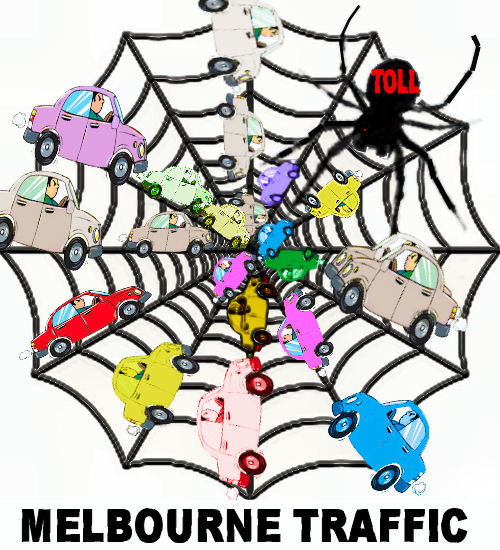
 (Article by Sally Pepper.) On New Year's Day, January 1st 2018, as I surfaced around 10.00 a.m, I heard on the news that power prices and tolls on roads around Melbourne will both increase and, that this year many Victorians will experience additional economic hardship. My immediate defensive thought was, "Well I don't use tollroads and I guess I can be more frugal with my use of gas and electricity."
 Chief of Staff to former Prime Minister Tony Abbott, Peta Credlin, is the latest to question Australia’s mass immigration program, which flooded NSW (read Sydney) and VIC (read Melbourne) with a record 185,500 net overseas migrants (combined) in the year to June, further crush-loading our two biggest cities. This article was first published on Macrobusiness at
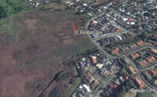
  Check out the advertising: “Divide and Conquer Unsurpassed Development Opportunity.” Tootgarook Swamp on the Mornington Peninsula is under widespread threat from developers. They need your help. 92 Elizabeth Ave, Caple Sound, is for sale for 'environmentally friendly' residential development (a contradiction in terms). Environmentalists suggest that this might be the least developable block on the entire Mornington Peninsula, due to flooding risks alone. Meanwhile, the site's biodiversity values are incredible and that’s without even considering the site's implemented VCAT order for illegal clearance, P2706/2016. The site's values and species need your help to step forward and make a stand for biodiversity on the Southern Peninsula. The site serves as critical habitat for one federally listed wetland bird, and is also utilised by many migratory and state listed species. Please write to your Councillor, you State and Federal Members requesting that this site be acquired by purchase and protected forever. Please share this message with those who care about Tootgarook Swamp and the Peninsulas biodiversity.
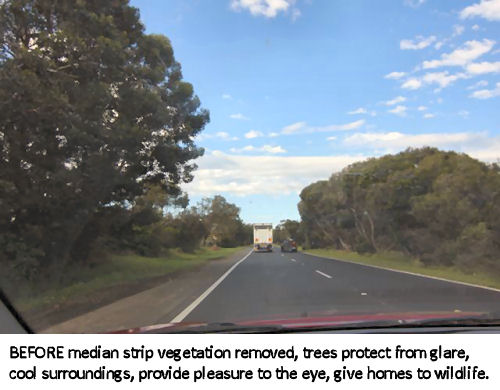
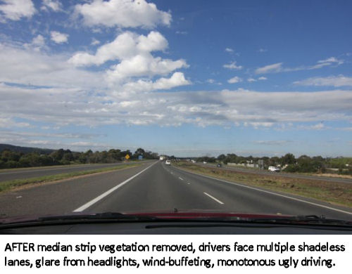
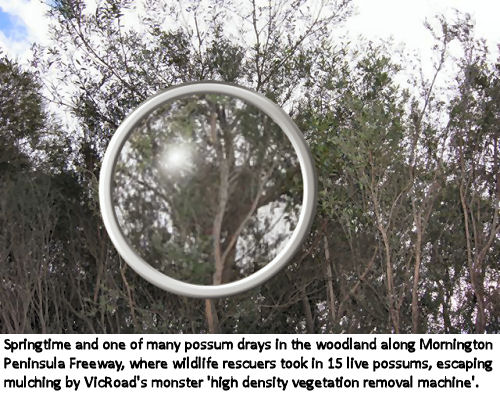
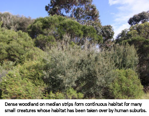
 VicRoads doesn't really respect wildlife corridors and rarely includes wildlife crossings in its vast expensive highways, despite its


 Alex Jones! Infowars! I hear you say. Aren't they the far-right conspiracy theorists? Isn't Alex Jones a card-carrying nutcase? Well, that's what the mainstream press say about him and his followers, all 50 m plus.[1] Mainstream media is on the way out, but Jones is on the way up and he really puts on a show. Maybe judge the pudding by its contents, which vary. But sometimes Infowars seems to really hit the nail on the head. Before you scoff, check out the following video, which is about planning threats to self-government in Austin Texas. Remind you of Australia's cities and towns? You won't hear it on the mainstream news.
 Community outrage continues in the battle to protect the iconic Dandenong Ranges from inappropriate development following Knox Council’s recent failure to adopt the independent Panel recommendation for mandatory maximum height controls in the Upper Ferntree Gully Activity Centre. Knox Appropriate Development Alliance President, Catherine Kruse said that a petition to the State Government calling for their intervention is gathering momentum with interest from across Victoria. A rally is also planned for Monday February 27th at the Knox Council offices.


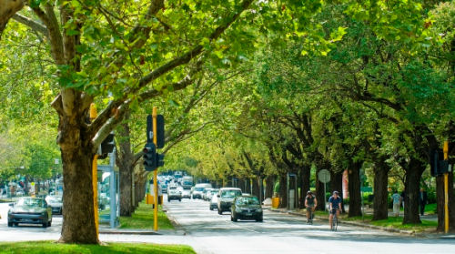
 (Submission inside) Plans for the proposed underground railway from north west to south east of the city are not yet finalised. On Friday the 13th the Minister of Planning said the location of the proposed Domain station may be moved and yet the Age announces 14th Jan that work would begin on Monday the 16th. This is clearly vandalism. They are going to start destroying trees and moving gas and sewer lines at the Domain. Remember that St Kilda Road is heritage listed and Heritage Victoria have received thousands of objections and Heritage Vic have not yet made a determination. One has to wonder how much pressure they are under by this State Government in their determination to start digging. We are sick to death of hearing them say they are 'shovel-ready'. How dare the government say that the damage to St Kilda road will be worth it for the advantage the rail will give. The necessity for this rail is being questioned by respected planners in Melbourne. There are far more important road and rail projects that are needed first.
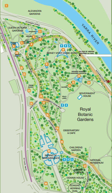

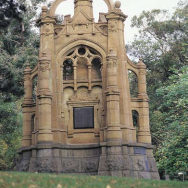
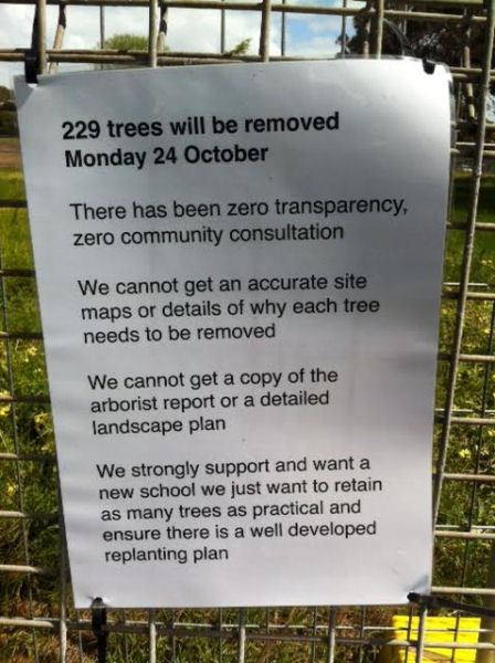
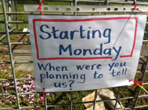
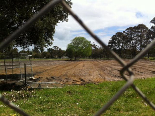
 Photoessay by Jill Quirk. Protest 6.45 am; Location: Beaumaris Secondary School, Reserve Road, Between Gramatan Avenue and Balcombe Road, Beaumaris. Wear red to show anger. Today I took photographs of the scene at Beaumaris Secondary College where 229 trees are scheduled for the chop tomorrow morning at 6.45 a.m. The area is fenced off as a demolition and building site. It looked to me as though a lot of vegetation if not trees has already been cleared and as though a couple of exhibits will be left in isolation for aesthetic purposes as solitary reminders of nature. I’m sorry for the displaced wildlife, especially possums who will no doubt find their way into the gardens of unwelcoming residents. One of the notices on the fence said that they want a new school but retaining as many trees as possible. Who is the new school for ? Current residents or for a large expected influx from overseas?

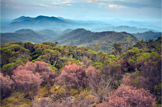
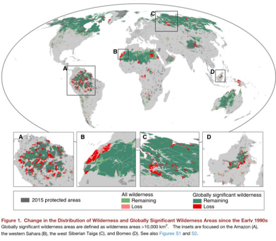
 A University of Queensland-led international study released today reports catastrophic declines in wilderness areas around the world over the past 20 years. UQ School of Geography, Planning and Environmental Management and Wildlife Conservation Society in New York researcher Associate Professor James Watson said findings demonstrated alarming losses comprising a 10th of global wilderness since the 1990s. The report discovered that a total of 30.1 million km2 (or 23.2% of terrestrial areas) of the world’s land area now remains as wilderness, with the majority located in North America, North Asia, North Africa, and the Australian continent. An estimated 3.3 million km2 has been lost since the early 1990s (approximately a 9.6% loss in two decades, with the most loss occurring in South America (experiencing 29.6% loss) and Africa (experiencing 14% loss). [1]

 Why has a Greens Population/Sustainability Working Group Member been vilified as racist and sexist and harassed with threats of expulsion for sticking up for our wildlife against needless rapid population growth? Read what Geoff Dowsett wrote and the response he got from candidate Tamara Ryan (included in the article).


 Victoria Market, as we know it, is under threat. The City of Melbourne, along with the top end of town, has plans to reduce and gentrify our historic market, paying lip service only to its valued heritage and the important service it provides to the wider Melbourne community, in particular, its role in keeping food quality standards high, food prices down, while providing astounding diversity.
  The OpenAustralia Foundation, the charity that runs a
 Entirely predictably, the Murray Darling river system is toxic with effluent again, host to masses of poisonous cyanobacteria. As the Weekly Times reports, "WATER will be switched off to hundreds of farmers and town residents in the Mallee this week as the Murray River blue-green algae emergency worsens. The toxic outbreak now involves almost 500km of the Murray River and has claimed reservoirs, rivers, wetlands and parts of Victoria’s two biggest irrigation districts. Taps were turned off to towns and farms in parts of the southern Mallee late Friday when the algal bloom reached key Wimmera Mallee pipeline pumps near Swan Hill, catching most residents unaware. Experts said a record autumn heatwave, with temperatures soaring above 40C in northwest Victoria this week, was expected to grow the algal bloom until it choked almost all of the Murray River along the NSW-Victoria border within weeks."[1] But these problems have been known for so long now, it seems foolish to believe that we can hope for any resolution that would keep the vast Australian desert from claiming on our only major inland river system. Certainly we should not meddle with the northern river systems, but unfortunately our psychopathic leaders have already started.
 Estonian House, West Brunswick, 24th February
 As previously, there was the muffled threat that this new version of suburban planning, which can only increase occupier density in a municipality with the highest or second highest density in greater Melbourne, was driven by State Government (of a different stripe, but the threat remained the same), and the heavy implication that it might be worse if we did not agree.
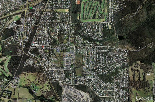
 Bearing in mind the recent Crib Point tragedy - a suspected arson attack, with wildlife loss yet to be detailed, one home destroyed and one home damaged plus several sheds destroyed, we have to be more vigilant about how and whether we develop our bushland neighbourhoods more densely. Planning laws allow property owners to remove large amounts of vegetation without permission from their land citing their reason as 'fire protection'. After the vegetation is removed, those property owners may apply to the council for permission to intensify development on the land. Council usually does not deny permission for individual cases. But such individual cases mount up and create a danger which councils and planners may not have seen. The risk is that the granting of denser housing development in a bushland area means that, if there is a fire in the remaining bushland, there will be an increased number of residents needing to evacuate. Increasing population density means that more roads are needed to cope with a fire emergency evacuation. However, densification is being allowed to happen in an ad hoc, case by case fashion, without the building of roads in advance of significant development. No-one is overseeing the total impact.
 The function of Australian mass media seems to be to inveigle listeners into complicity in the terrible transformation that is being visited on us in Australia (turning what were once pleasant capital cities where most of us now live, into dystopian megalopolises) by inviting them to 'choose' between distasteful solution A or unpleasant solution B.
 With Victoria going to the polls on Saturday,


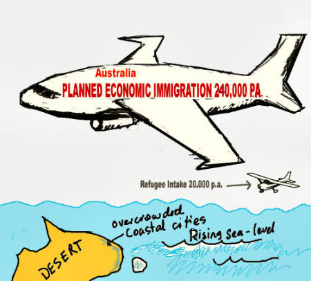
 The Federal Government is not the sole responsible for Australia's planned and economic immigration; in fact the States seem to be leading it. State governments and political parties tend to try to mislead Australians on this very issue, so I felt it was time to write an article. Now is the time to head to your local member's office and ask him or her what he or she is going to do about this. If you don't get a sensible answer, vote small parties before Lib, Lab or Green.
 Your most telling examples of how the States impact on immigration are the State migration websites. The States 'nominate' migrants. I think the Feds just pretend to 'vet ' them. In Victoria it is

 Draft Planning and Development Bill 2014 (P&D Bill) and Planning and Environment Court Bill 2014 (P&E Court Bill) now in progress within the Queensland Dept of State Development, Infrastructure and Planning (DSDIP) threaten all that has been achieved in defeating Rainbow Shores Stage 2 so far. The Bills would provide our local Govt. with the power to make future planning changes, and take decisions regarding this development (as well as many others) without any public scrutiny or control. We know how woeful their performance on RS2 has been to date. They cannot safely be allowed these additional planning and approval powers.
 I apologise for the extremely late notice on this matter but I have only just been informed of the situation. This lateness is itself a direct result of the across the board funding cuts by both State and Federal Govts. to community Environmental networks and the resultant lowered capacity these networks now have to respond quickly and adequately to such things.
 Tuesday 16 September 2014. A Westernport community group representative has headed to Switzerland today to present the Ramsar Convention Secretariat, the body in charge of international wetland treaties, with a letter outlining the imminent threat posed by the massive Port of Hastings development to the bay's extensive wetlands.

 Environment and community groups from across Australia are calling on Federal Environmental Minister Greg Hunt to save the fragile environment of Westernport Bay amid ongoing concerns over the Coalition’s One Stop Shop policy.
 Western Sydney residents are up in arms about having an urban rail line, a freight rail line and a mega motorway through their communities and bushland. Hundreds will be protesting 6.30 pm Thursday 7 August, 2014, at the St Marys Community Centre, St Marys, NSW, Cnr Mamre Rd & Great Western Hwy., where Transport for NSW and Tanya Davies the local Liberal MP have reluctantly agreed to hold an extraordinary community consultation drop in session. They want to know what we think of their plan so we intend to let them know loud and clear: 'We don't like it'.
 Environment Minister Greg Hunt has caved to the mining industry and approved Indian mining giant Adani's monstrous Carmichael Mine, threatnening the Great Barrier Reef. The coal mine will be the biggest in Australia. It will pollute our climate with massive CO2 emissions for decades. It will mean massive and continual dredging and dumping in the Great Barrier Reef World Heritage Area and will fill the Reef with thousands of coal ships every year. Original article and petition from GetUp. Note that, if you sign, GetUp puts you on two mailing lists, however the situation is serious and their campaign may be effective.
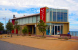

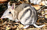 If you are concerned about 457 visas, local unemployment and population growth, planning issues, over-development, and the loss of wildlife and residents rights in Frankston and the Peninsula, please come along to this meeting of Victoria First. Special Guest Speaker will be Public Transport advocate Mr. Ian Hundley. Ian Hundley will speak on "The transport crisis in the Frankston area: issues of economy, ecology and social connectedness." This public meeting will be from 2-4pm at the Frankston Life Saving Club, on Frankston Foreshore. (More details of location inside article.) There will be opportunities to make statements from the floor if you let the organisers know in advance. Contact 03 9350 5777.
 Tomorrow, Saturday 28 June 2014, thousands are expected to pour onto the streets to take a final stand against the monstrous $14 billion East West Link (EW Link) project about to be foisted on the long suffering people of Victoria by - in our view - the incompetent and increasingly unpopular Napthine Government. Demands of the rally are: scrap the E W Link Toll Road; rip up the contracts if/when signed; and invest in public transport.
 Additionally the call has gone out for the Coalition to make the EW Link an election issue and to resist signing contracts before “the people” have spoken. Protestors will rally outside The State Library at the corner of Swanston and Latrobe Streets by 1 pm tomorrow, hear speeches and then march to Flinders Street Station.


Recent comments